What Is a Geotechnical Site Investigation?
Geotechnical site investigations are vital to any new construction project or potential property transaction. The site investigation yields a “window” into a site’s subsurface characteristics. They are performed to collect data regarding the subsurface’s hydrogeologic, soil, and rock characteristics within a proposed or existing development site. The investigation will help identify the subsurface design of a new building. The data collected may also provide information that can represent safety hazards that can be associated with a future construction project. The data a geotechnical site investigation provides is critical when deciding the geotechnical design criteria for a project or identifying the potential issues that can be encountered on a property prior to the transaction, i.e., can we expand our existing building? Using soil profiles, groundwater modelling, and other various tools, geologists and engineers can gather baseline datum for a property. This information can help project managers predict cost, materials to use, possible remediation and, most importantly, help avoid delays for their clients. Investigating the subsurface of a site geotechnically will ultimately save your clients time, money and aggravation, not to mention return business and referrals. A properly conducted geotechnical site investigation has four distinct phases.
Phase I - Site Reconnaissance
The first step of a geotechnical site investigation is to perform site reconnaissance. It is important to note and map out the property’s boundaries and gather data on the adjacent properties for potential risks. An essential and often overlooked aspect of site reconnaissance is the use of aerial photographs, both taken in the past and present. Aerial photographs contain information pertinent to conducting a thorough investigation. Noting past vegetation, development, drainage patterns, and topography of the property and surrounding areas can give your site reconnaissance direction before you ever set foot on site. This phase of the overall investigation will generally require a physical site visit to visually, topographically, and geologically examine a property. Using past soil boring and well logs, static water level data, nearby bodies of water, vegetation, soil composition, flood plain maps, geological maps, blueprints, and other public records are essential for an accurate review. The site reconnaissance phase will help establish a baseline of the property and will form hypotheses of what precisely the geotechnical site investigation needs to address.
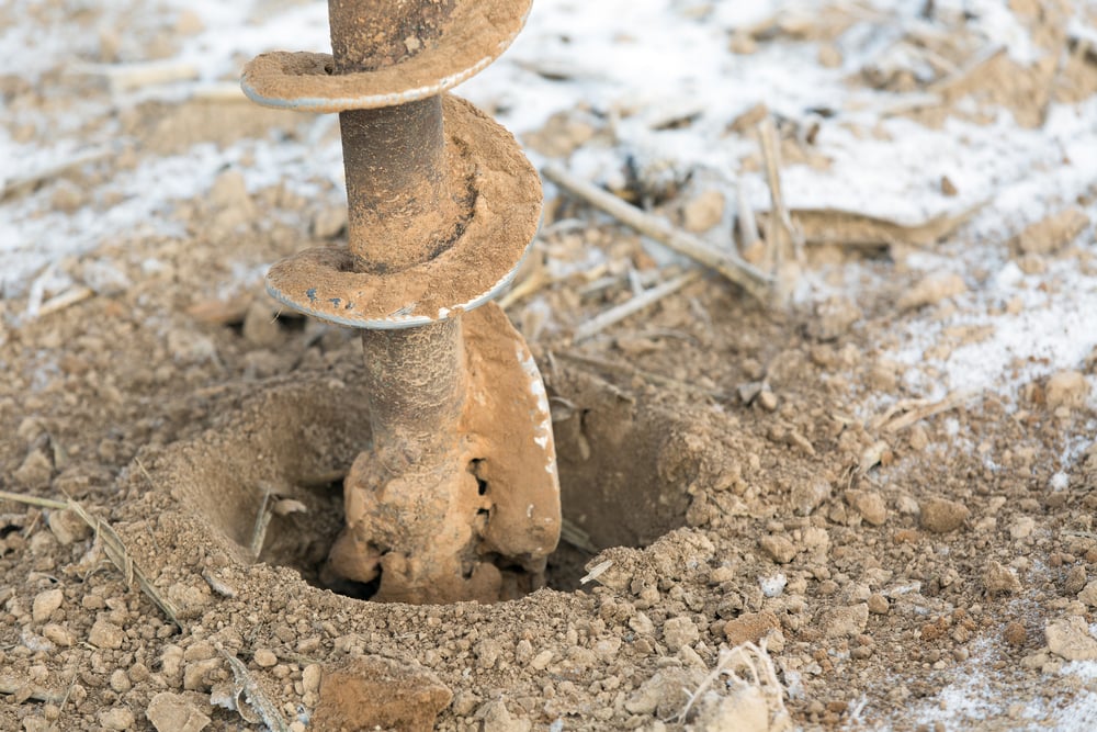
Phase II - Site Exploration
Using information gathered from the site reconnaissance, the next step is to organize and analyze the property's soil, groundwater, and rock characteristics. This will lead to the design of a soil investigation involving the advancement of soil borings and the collection of geotechnical soil samples. Sufficient planning should occur before conducting site exploration to create a focused and detailed effort and to collect needed data from the correct locations and depths. During this phase of a geotechnical site investigation, soil borings, groundwater monitoring wells, and soil mechanics tests are conducted to investigate the subsurface further. Soil borings will give a detailed geologic profile in regard to what the project might encounter. Monitoring wells is necessary for quantifying groundwater and understanding how it flows throughout the property subsurface. Soil characteristics such as shear strength, bearing ratios, permeability and porosity information help the designers understand the physical properties of the subsurface soil and introduce what limiting construction factors a proposed project or transaction will encounter. Depending on subsurface characteristics and building design, each site will require different numbers of the correct samples and tests. Sampling is a significant part of the exploration. Creating a sampling plan for media will ensure the accuracy and, thus, the success of the proposed construction efforts. The main objective of this process is to fully understand all the physical and geochemical properties of a property’s subsurface.
Phase III – Data Interpretation
After all pertinent data is collected and analyzed, the interpretation process can begin. Engineers and geologists create maps, models, tables, and figures that show the data in an easy-to-use format. Accurate interpretation is vital in determining construction design, materials, limiting factors, safety requirements, and, ultimately, the cost of a project. Professionals will interpret the data to create conclusions and recommendations.
 Phase IV – Reporting
The final step is to create a report for the client or potential purchaser for their review. The report will explain all sample collection methodologies in detail, a presentation of the data, interpretation of the data, and the engineer’s conclusions, including design recommendations. Reports guide future development, sales, and activities to be conducted on a property. Reports compile all the phases of a geotechnical site investigation and make that data useful.
In conclusion, geotechnical site investigations limit the danger, produce results, and save money. So before you take on a construction project or purchase a property, ask yourself, “What’s in the Subsurface?”.

.jpg)